presentations
A list of our past presentations.

| 2026.02.02 |
Automobility in Flux: Adoption and Use of Emerging Automotive Technologies in Cities, and the Future of Sustainable Transportation
Michael Montilla PhD student, University of California - Berkeley
The growing popularity of electric vehicles (EVs) forces transportation agencies to consider the demand, and optimal location for public EV charging infrastructure. Most public charging stations are privately owned, and cluster near destinations or along highways. These trends, coupled with the convenience of at-home charging, has led to a scarcity of charging infrastructure in urban residential areas where potential users may not have a dedicated place to park a vehicle and charge. Ironically, urban drivers may be more inclined to use EVs compared to other drivers because of shorter commutes and lower range anxiety, but without a place to change at home, many forego adoption. For the second installment of the Spring 2026 eMERGE speaker series, Mike Montilla explores this issue, and presents recent research examining how the availability of public chargers, and policies promoting installation of public chargers within urban neighborhoods relate to EV adoption in dense cities with limited at-home parking.
Michael A. N. Montilla is a PhD Candidate at the University of California, Berkeley in the Department of City and Regional Planning, and researcher at the California Partners for Advanced Transportation Technology (PATH). His work focuses on the intersection of emerging transportation technologies, sustainability, networked infrastructures, and urban planning and policy. Specifically, he researches how introduction of ride-hailing related to changes in vehicle use and ownership across urban geographies, how autonomous vehicle use impacts travel costs and urban density, and how governments and individual actors incorporate electric vehicles (EVs) into everyday travel. His approach to research can be summarized by prioritizing identification of high quality, and granular data sources including comprehensive vehicle inspection records, and fleet telematics. Beyond research, he teaches courses on urban and regional transportation planning, and environmental design research methods.

| 2026.01.26 |
Mobility Networks for Pandemic Response & Emerging Directions with Generative AI
Serina Chang Assistant Professor, University of California - Berkeley
During the COVID-19 pandemic, mobility networks derived from aggregated cell phone location data became a powerful tool for measuring population movement and inferring real-world contact patterns. In this talk, I will discuss my PhD research on mobility networks for pandemic response, describing parts of my job talk and job market experience. At the end, I’ll discuss some emerging directions from my new lab around generating mobility trajectories with generative AI models.
Serina Chang is an Assistant Professor at UC Berkeley, jointly appointed in EECS and Computational Precision Health and part of the Berkeley AI Research Lab (BAIR). Her research falls at the intersection of AI and human behavior, including modeling human behaviors with AI, evaluating and improving human-AI interaction, and developing AI tools for societal decision-making, with a focus on public health. Her work is recognized by the ACM SIGKDD Dissertation Award, KDD Best Paper Award, Forbes 30 under 30, Google Research Scholar Award, EECS Rising Stars, and Rising Stars in Data Science, and has received coverage from over 650 news outlets, including The New York Times and The Washington Post.
| 2025.11.17 |
Adaptive Engineering of Heterogeneous Materials and Devices for 3D Energy-Efficient Electronics
Fabia Farlin Athena Postdoctoral Fellow, Stanford University
Data-intensive computing, exemplified by artificial intelligence (AI), is reshaping our lives, from healthcare to home security, but at a steep energy cost. In modern computing, most energy is spent moving data rather than processing it, creating an energy bottleneck known as the memory wall. Overcoming this challenge is crucial to enabling the energy-efficient electronics required for sustainable AI. Approaches such as analog in-memory computing and high-density, 3D on-chip memory offer the potential to overcome this bottleneck. However, realizing these approaches requires innovation in the fundamental building blocks of hardware, which, in turn, demands advances in device and materials engineering, including transport physics, interfaces, and integration. I will discuss how adaptive engineering leverages heterogeneous materials and devices to meet device-specific requirements and thus enables energy-efficient electronics. I will present key examples from my work. The first involves optimizing transport, interfacial, and thermal properties to enable adaptive oxide-based, low-power, non-volatile resistive random access memories for deep learning applications and exploit bias-induced phase transitions. The second leverages interface dipole engineering, monolithic 3D integration, and nanoscale process innovation for amorphous oxide semiconductor (AOS) two-transistor (2T) gain cell memory. Finally, I will conclude by outlining my vision, which combines adaptive engineering of novel materials and devices, 3D integration, and sustainable manufacturing to achieve unprecedented energy efficiency in computing hardware.
Fabia Farlin Athena is an Energy Postdoctoral Fellow in Electrical Engineering at Stanford University, advised by Prof. H.-S. Philip Wong and Prof. Alberto Salleo, studying high density on-chip oxide-semiconductor gain-cell memories and monolithic 3D memory-logic stacks for ultra-low-power AI hardware. She earned her PhD and MS in Electrical and Computer Engineering from Georgia Institute of Technology, advised by Prof. Eric M. Vogel, where her research focused on adaptive oxide-based resistive memories for deep learning applications, receiving the Sigma Xi Best PhD Thesis 2025. She has also held research scientist intern roles at IBM T. J. Watson Research Center. Athena’s research has been recognized by the IBM PhD Fellowship, MRS Graduate Student Award, Cadence Technology Scholarship, VLSI Symposium Highlight Paper, EECS and MSE Rising Stars, Stanford Energy Postdoctoral Fellowship, and Forbes 30 Under 30 North America.

| 2025.11.10 |
Real-time Control of Critical Infrastructure in Times of Scarcity
Sophie Hall PhD Student, ETH Zurich (Switzerland)
For decades, humanity operated under an illusion of abundance, exploiting oil, water, land and other planetary resources as if they were infinite. This paradigm is shifting as we confront resource scarcity. Automation technologies are deployed across critical infrastructure to optimize how energy grids, water networks, and transportation systems distribute finite resources efficiently.
In this talk, I will present three control perspectives and methods developed during my PhD that ensure efficiency, fairness, and welfare in closed-loop operation of large-scale infrastructure systems: (1) Game-theoretic MPC: An emerging control methodology modeling competitive self-interested agents with shared resources while incorporating predictions, dynamic models, and constraints into decision-making. I will present energy management results from a collaboration with a local DSO in Switzerland. (2) Welfarist control theory: A principled approach to aggregate incomparable heterogeneous cost functions, applied to water management. (3) Robust control techniques for maximal system efficiency in compute load allocations, developed with Google's Carbon Aware Computing team.
Sophie Hall is a PhD student at the Automatic Control Laboratory at ETH Zürich since May 2021, working in Prof. Dörfler's group. She completed her undergraduate studies in Mechanical Engineering focusing on medical control and signal processing at the University of Surrey, UK, and Nanyang Technological University, Singapore. In 2021, she obtained MSc in Biomedical Engineering from ETH Zürich specializing in modeling and control. During her master's studies, she conducted research on Gaussian processes for control in Prof. Zeilinger's group and worked on real-time MPC schemes in Prof. Dörfler's group. Her PhD research focuses on game-theoretic MPC, its theoretical closed-loop properties, as well as energy and groundwater applications.

| 2025.11.03 |
The global energy transition is transforming power systems through the rapid growth of renewables, data centers, and electrification across transportation, infrastructure, and industry. This talk highlights two critical challenges and our proposed solutions. First, distributed energy resources (DERs)—such as rooftop solar, home batteries, and electric vehicles—along with large new loads like data centers, require reliable and fair access to the distribution network. We introduce a dynamic operating envelope market, implemented through a forward auction, to allocate network injection and withdrawal rights. This mechanism enhances grid reliability while enabling equitable participation of diverse resources. Second, unlocking demand-side flexibility requires energy service providers to better understand customer behaviors and preferences in order to design sustainable and profitable business models. We develop AI agents powered by large language models that act as homo silicus for energy customers. These agents generate credible and diverse behavioral insights and capture responses to rare but high-impact events such as blackouts. Together, these approaches address renewable uncertainty, maintain competitive pricing, and advance demand-side participation in modern electricity markets.
Cong Chen is an assistant professor at Dartmouth College. She was selected as a Stanford Energy Fellow in 2024. She received her B.E. degree from Wuhan University, M.S. from Tsinghua University, and Ph.D. from Cornell University, all in Electrical Engineering. Her research aims to drive the global energy transition through principled engineering solutions rooted in optimization, economics, and modern machine learning/AI. In particular, she has research experience in large-scale distributed energy resource aggregation, pricing under uncertainties, energy storage integration in the electricity market, large language models for energy consumers, and hydrogen storage for grid resilience. She was an intern at ISO New England. She has received multiple honors, including Cornell ECE Outstanding Ph.D. Thesis Award (2024), Engineering and Applied Science Trailblazing Young Researcher at Caltech (2023), Best Paper Awards at the IEEE Power & Energy Society General Meetings (PESGM, 2019, 2024, 2025), Prize Conference Paper Award at the IEEE PESGM (2023), Amazon Research Award (2025), Best Presentation Award at the Ph.D. Dissertation Challenge during the IEEE PES Grid Edge Technologies Conference & Exposition (2025), and IEEE PES Outstanding Doctoral Dissertation Award (2025).

| 2025.10.27 |
Electric Vehicles and the Grid: Managing Infrastructure Strain, Vehicle-to-Grid Potential, and Emissions
Sonia Martin PhD Student, Stanford University
Rapid growth of passenger electric vehicle (EV) adoption raises many challenges associated with increased electricity demand from charging. Limited electricity grid infrastructure capacity, expensive grid equipment costs, and emissions from electricity generation are all issues that EVs can exacerbate. However, EVs and other distributed energy resources (DERs), such as residential batteries, are flexible loads that can be managed to alleviate these challenges. This talk focuses on testing traditional management techniques for EVs and DERs to assess their efficacy given growing EV adoption. Specifically, we examine residential battery aggregation, vehicle-to-grid (V2G) charging economic feasibility, and managed EV charging for emissions reduction, and we propose solutions if traditional management methods fail. Together, this work helps accelerate near-term EV and V2G adoption with recommendations for best practices for EV and DER management.
Sonia Martin is a PhD candidate in the Stanford Sustainable Systems Lab, advised by Prof. Ram Rajagopal. Her research centers around electric vehicles (EVs) and their integration with the grid. Specifically, she designs optimization algorithms both for managed EV charging and residential battery storage operation to reduce emissions, costs, and grid infrastructure upgrades from increased EV adoption. Sonia received her M.S. from Stanford University in 2022 and B.S. from UC Berkeley in 2020, both in mechanical engineering.
| 2025.10.13 |
Heavy-duty road transportation is among the most challenging sectors to decarbonize globally. Battery electric trucks (BETs) and fuel cell electric trucks (FCETs) have been proposed as key pathways toward zero-emission freight. However, technical and economic barriers continue to constrain their large-scale deployment, and the diverse usage scenarios of heavy-duty road transportation requires fleet-tailored solutions. New sources of real-world operational datasets (e.g., on-board sensing data, geospatial datasets) and computational methods enable us with more realistic assessments of truck decarbonization pathways. In this talk, I will present our recent observations on behavioral bottlenecks, evaluation and projection on technological feasibility, cost competitiveness, and decarbonization potential of low-carbon trucks, with a focus on practices across China, Europe, and the United States.
Pei Zhao is a Postdoctoral Fellow at MIT Senseable City Lab. Her research investigates the bi-directional influences of human behavior and energy-climate systems: how individual and collective behaviors shape the feasibility and impacts of low-carbon technologies, and how environmental and technological transitions in turn reshape human decision-making and behavior. Before joining MIT, she received her PhD in Environment Engineering in 2024 from Tsinghua University. Her Ph.D. studies focus on decarbonizing heavy-duty road transportation. She holds a bachelor’s degree in environmental science and engineering from the School of Environment, Tsinghua University (2019), along with a dual bachelor’s degree in economics from the National School of Development, Peking University (2019).
| 2025.10.06 |
Technological advances have opened new avenues for designing market mechanisms in sociotechnical and urban infrastructure systems, from improving allocation efficiency through widespread data availability to enabling real-time algorithm implementation. While these advances hold significant promise, they also introduce challenges around equity, privacy, data uncertainty, and security that traditional mechanisms often fail to address. My research develops data-driven and online learning algorithms and incentive schemes to tackle these challenges, advancing the science and practice of market design for socially sustainable resource allocation in large-scale sociotechnical and urban infrastructure systems. In this talk, I will highlight my work on designing approximation algorithms for NP-hard problems that emerge when incorporating fairness and security considerations into smart mobility applications. Specifically, I will discuss new approaches for incorporating fairness considerations in congestion pricing and scalable algorithms for multi-resource Bayesian Stackelberg security games, illustrating both the theoretical contributions and their applications in traffic management and parking enforcement.
Devansh Jalota is a Postdoctoral Research Scientist at Columbia University’s Data Science Institute (DSI) and an incoming Assistant Professor at Georgia Tech’s H. Milton Stewart School of Industrial and Systems Engineering (ISyE), beginning in Fall 2026. His research develops data-driven learning algorithms and incentive schemes to advance both the science and practice of market design for sustainable and socially aware resource allocation, with applications in future mobility systems and electricity markets. He received his PhD in Computational and Mathematical Engineering from Stanford University, where he was a Thomas C. Nelson Stanford Interdisciplinary Graduate Fellow and a TOTAL Innovation Scholar. His work has been featured in outlets such as The New York Times and recognized with several Best Paper nominations at the INFORMS Annual Meeting. Prior to Stanford, he earned a BS in Civil and Environmental Engineering and a BA in Applied Mathematics from the University of California, Berkeley.

| 2025.09.29 |
Traffic systems are rapidly evolving toward mixed autonomy, where human-driven and automated vehicles (AVs) coexist. Achieving safe, efficient, and sustainable mobility in this setting requires algorithms that combine the strengths of traditional models, the flexibility of machine learning, and the practicality of control design and experimentation.
In this talk, I will present my research on physics-informed learning and control for mixed autonomy traffic systems. I begin with the CIRCLES project, where we showed that carefully designed control algorithms for a small fraction of automated vehicles can dissipate stop-and-go traffic waves and reduce fuel consumption. These results were validated in the MegaVanderTest, a large-scale field deployment of 100 AVs on a busy section of I-24 during the morning rush. This motivates the need for accurate, scalable models of traffic dynamics to guide such strategies. At the modeling level, I will introduce the Neural Finite Volume Method (NFVM), a physics-informed machine learning architecture for hyperbolic PDEs that embeds conservation laws, achieving up to an order of magnitude lower error than classical schemes such as Godunov’s method, outperforming ENO/WENO, and rivaling discontinuous Galerkin solvers at far lower complexity. Additionally, I will highlight how this research extends toward a broader vision: combining modeling, control, and real-world experimentation to advance intelligent mobility systems.
Zhe Fu is a Ph.D. candidate in Transportation Engineering and an M.S. candidate in Electrical Engineering and Computer Sciences (EECS) at the University of California, Berkeley, affiliated with Berkeley Artificial Intelligence Research (BAIR) and California PATH. Her research focuses on learning, control, and modeling for distributed parameter systems, with an emphasis on mixed autonomy. She develops physics-informed neural models of hyperbolic partial differential equations (PDEs), designs both model-based and data-driven control algorithms, and validates her work through large-scale field experiments. Zhe has been recognized as a 2025 Eno Fellow and was the Runner-up in the 2025 Berkeley Grad Slam. Her research has received honors across multiple communities, including First Place in the INFORMS Poster Competition (2023) and Rising Stars Award in Mechanical Engineering (2024), EECS (2025), and NSF CPS (2025).
- A Tutorial on Neural Network-Based Solvers for Hyperbolic Conservation Laws: Supervised vs. Unsupervised Learning, and Applications to Traffic ModelingAlexi Canesse, Zhe Fu, Nathan Lichtlé, Hossein Nick Zinat Matin, ... Maria Laura Delle Monache, Alexandre M. Bayen, (2025)Proceedings of the International Conference on Neuro-symbolic Systems , pp. 708–720
| 2025.09.22 |
Modern Artificial Intelligence (AI) and Machine Learning (ML) algorithms can deliver significant performance improvements for decision-making under uncertainty, where traditional, worst-case algorithms are often too conservative. These improvements can potentially be transformative for energy and sustainability applications, where rapid advances are needed to facilitate the energy transition. However, AI and ML typically lack provable performance guarantees, hindering their deployment to real-world problems in energy and sustainability where safety and reliability are critical. In this talk, I will discuss recent work developing algorithms that bridge the gap between the strong average-case performance of AI/ML and the worst-case guarantees of traditional algorithms. In particular, I will focus on the question of how to robustly leverage the recommendations of black-box AI “advice” for general classes of online optimization problems, describing both algorithmic upper bounds and fundamental limits on performance in these settings. In the second half of the talk, I will move beyond this black-box approach, highlighting recent steps toward developing new risk- and reliability-aware methods for ML training to enable better decision-making performance. Throughout, I will emphasize applications of these frameworks to energy and sustainability-related problems such as energy resource management and sustainable computing.
Nicolas Christianson is a Stanford Energy Postdoctoral Fellow and an incoming Assistant Professor of Computer Science at Johns Hopkins University (starting Fall 2026). His research lies broadly at the intersection of algorithms, machine learning, and optimization, with a specific emphasis on the development of new, theoretically-grounded algorithms and AI/ML methods for reliable decision-making under uncertainty. Much of his work is motivated by modern energy and sustainability challenges, with applications ranging from energy resource operation to sustainable computing systems. Nico received his PhD in computing and mathematical sciences at Caltech in 2025, where he was supported by an NSF Graduate Research Fellowship and a PIMCO Data Science Fellowship. His PhD dissertation won Caltech’s Ben P.C. Chou Doctoral Prize in Information Science and Technology and the Demetriades-Tsafka-Kokkalis Prize in Renewable Energy. Before Caltech, Nico received an AB in Applied Mathematics at Harvard College.
- Optimal robustness-consistency tradeoffs for learning-augmented metrical task systemsNicolas Christianson, Junxuan Shen, Adam Wierman (2023)Proceedings of The 26th International Conference on Artificial Intelligence and Statistics , pp. 9377–9399
- Fast and Reliable {N - k Contingency Screening with Input-Convex Neural NetworksNicolas Christianson, Wenqi Cui, Steven Low, Weiwei Yang, Baosen Zhang (2025)Proceedings of the 7th Annual Learning for Dynamics }& Control Conference , pp. 527–539

| 2025.09.15 |
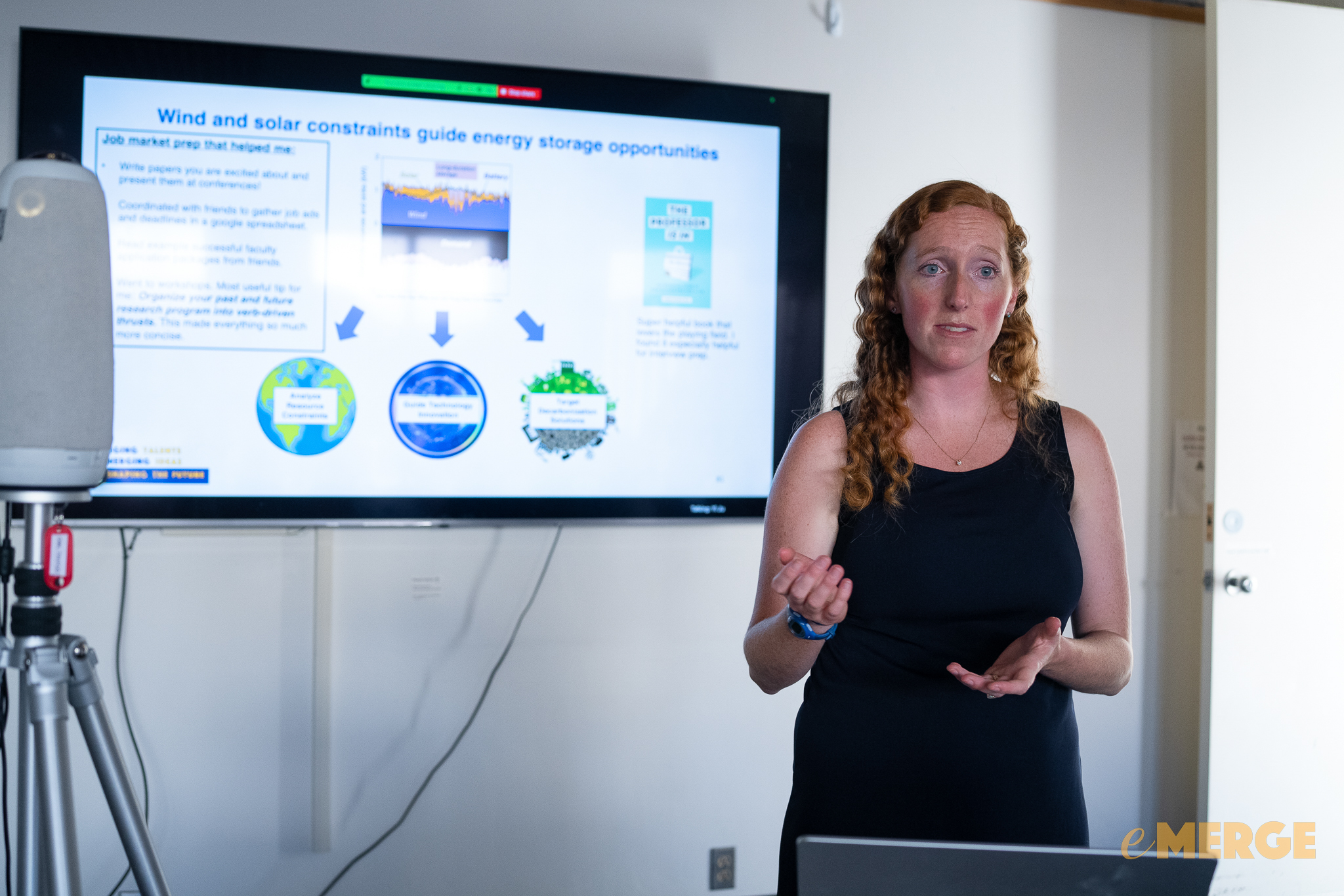
Clean energy transitions in many jurisdictions involve dramatic increases in shares of variable wind and solar power in their electricity grids, supplemented by clean firm power to provide reliability. To plan a resilient, clean energy future, we will need to account for natural resource constraints as we develop and deploy new technologies. To address this aim, I blend perspectives from earth science, energy system modeling, and energy economics. I will discuss my work that incorporates multi-decadal wind and solar weather data into energy system models, showing that it is critical to incorporate this variability for evaluating seasonal and interannual benefits of energy storage. Long-duration energy storage can make reliable wind-solar-battery electricity systems more affordable. Geologic hydrogen storage, thermal energy storage in dirt, and metal-air batteries are promising examples of this. In additional work, I estimate carbon abatement costs of building heat electrification constrained by temperature data at the U.S. census tract level. This talk illustrates that wind and solar constraints guide energy storage opportunities, and temperature constraints guide heat pump opportunities, informing energy infrastructure investment and research priorities.
Dr. Jacqueline A. Dowling (Jackie) models energy systems to guide the global transition to clean energy. She is currently a Stanford Energy Postdoctoral Fellow and will join the University of Iowa as a tenure-track assistant professor in Civil and Environmental Engineering in January 2026. Her research program analyzes natural resource constraints, guides technology innovation, and targets decarbonization solutions. Jackie uses weather data in macro-energy system models to guide reliable energy infrastructure plans and technology innovation. Recent focus areas include long-duration energy storage and heat pump adoption. Her dissertation combined techno-economic analysis and materials chemistry to assess the value of different energy storage and conversion technologies in wind- and solar-based electricity systems. She earned a PhD in Chemistry with a minor in Environmental Science and Engineering from Caltech. Jackie’s research on the role of long-duration energy storage has been cited by major utilities and in international, national, and state-level decarbonization plans.
- The Influence of Regional Geophysical Resource Variability on the Value of Single- and Multistorage Technology PortfoliosAnna X. Li, Edgar Virgüez, Jacqueline A. Dowling, Alicia Wongel, ... Nathan S. Lewis, Ken Caldeira, (2024)Environmental Science & Technology , Vol. 58 , No. 30 , pp. 13251–13262
- Catalysis of the Oxygen-Evolution Reaction in 1.0 M Sulfuric Acid by Manganese Antimonate Films Synthesized via Chemical Vapor DepositionJacqueline A. Dowling, Zachary P. Ifkovits, Azhar I. Carim, Jake M. Evans, ... Anna X. Li, Nathan S. Lewis, (2024)ACS Applied Energy Materials , Vol. 7 , No. 10 , pp. 4288–4293


| 2025.09.08 |
Tracking carbon emissions in near-real-time is essential for informing timely climate action and evaluating the effectiveness of mitigation policies. In this talk, Dr. Dou will introduce her work on developing the world’s first high-resolution, near-real-time datasets of CO2 and CH4 emissions by integrating satellite observations, ground-based activity data, and machine learning. The innovative methods are adopted in multiple international collaborative projects such as Carbon Monitor and GRACED, providing daily CO2 and CH4 emission estimates across multiple sectors for global coverage. Dr. Dou will also share how these data have been used to assess the immediate impact of socio-economic changes, such as the pandemic or energy crises, on emissions. Moving forward, this research aspires to shed light on the dance between the energy transition and GHG emissions, offering insights to guide future policy decisions and technological advancements.
Dr. Xinyu Dou is a Postdoctoral Research Fellow in the Department of Earth System Science at Stanford University, supported by the Stanford Energy Postdoctoral Fellowship. Her research centers on near-real-time monitoring of anthropogenic greenhouse gas emissions, with a particular focus on integrating top-down (satellite and ground atmospheric observations) and bottom-up (activity-based) data. She earned her PhD in ecology from Tsinghua University under the supervision of Prof. Zhu Liu, developing GRACED, the world’s first near-real-time, grid-level carbon emissions database on a daily scale. Xinyu is a key member of the international Carbon Monitor project and a contributor to the Global Carbon Project. Currently, she is collaborating with Prof. Rob Jackson to advance the study of methane emissions monitoring. Xinyu’s general research interests include high-resolution carbon emissions monitoring, carbon footprint, methane leak and energy transition.

| 2025.08.27 |
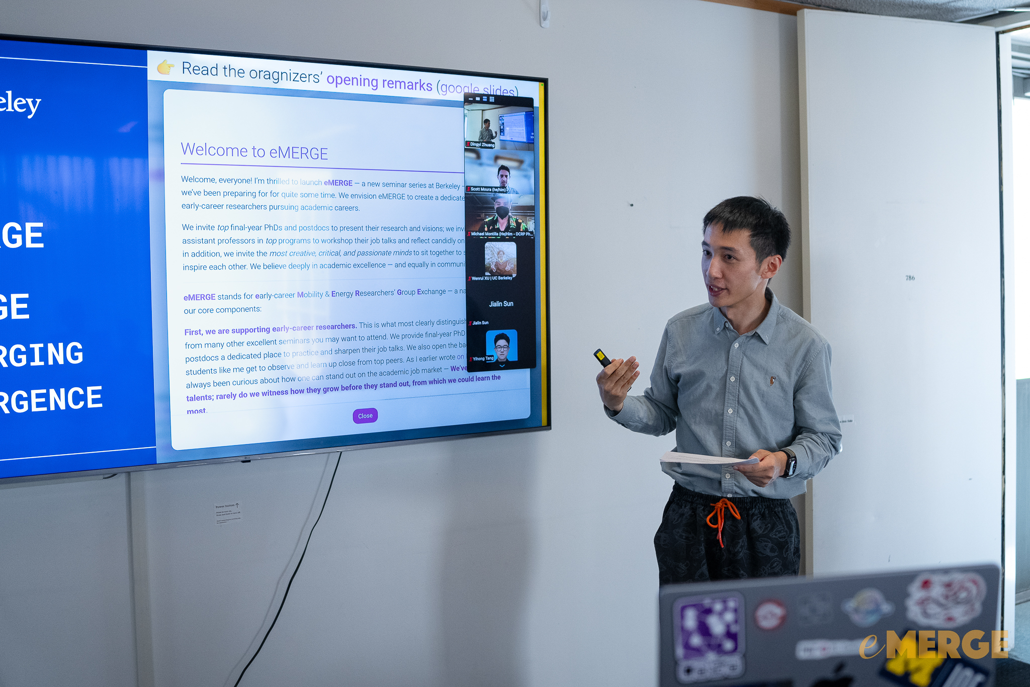
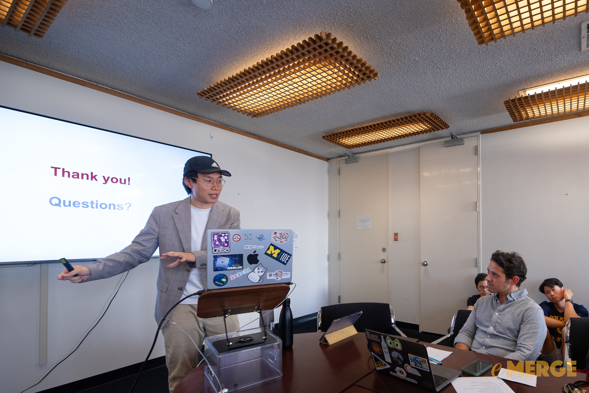
Cities are complex systems shaped by rich patterns across space and time. Understanding and predicting these patterns requires more than accurate models—it requires trustworthy spatial intelligence. In this talk, Dingyi Zhuang will present his research agenda along three complementary directions. First, he develops spatiotemporal and multimodal modeling frameworks with graph neural networks and tensor learning to capture and predict correlations across space and time. Second, he designs uncertainty quantification and calibration techniques to ensure that the relationships learned by these models are reliable, interpretable, and fair. Third, he extends toward spatial reasoning, leveraging large language models and vision-language models to embed physical constraints and social norms into learned structures, advancing toward richer world models of cities. Together, these directions outline a coherent vision: from learning relationships in spatiotemporal data, to validating their trustworthiness, to reasoning about the rules that govern urban environments.
Dingyi Zhuang is a final-year Ph.D. candidate in Transportation at MIT’s JTL Transit Lab, supervised by Prof. Jinhua Zhao. He received his M.Eng. from McGill University and B.Sc. from Shanghai Jiao Tong University. His research develops trustworthy AI and machine learning methods for transportation and urban systems, spanning spatiotemporal data modeling, uncertainty quantification, intelligent transportation systems, and generative AI for spatial reasoning and planning. Dingyi has also worked as a machine learning intern at the Bosch Center for AI, Morgan Stanley’s ML research group, and the Chicago Transit Agency. He received the UPS Fellowship at MIT, and won four workshop Best Paper Awards, with publications bridging both leading transportation journals (TR-C, AAP, IEEE T-ITS) and top computer science venues (IEEE TPAMI, ICLR (Spotlight), NeurIPS, AAAI, KDD, and EMNLP). Looking ahead, he envisions spatial intelligence as a foundation for trustworthy world models that integrate data with physical and social reasoning for urban decision-making.
- ITINERA: Integrating Spatial Optimization with Large Language Models for Open-domain Urban Itinerary PlanningYihong Tang, Zhaokai Wang, Ao Qu, Yihao Yan, ... Zhan Zhao, Wei Ma, (2024)Proceedings of the 2024 Conference on Empirical Methods in Natural Language Processing: Industry Track , pp. 1413–1432